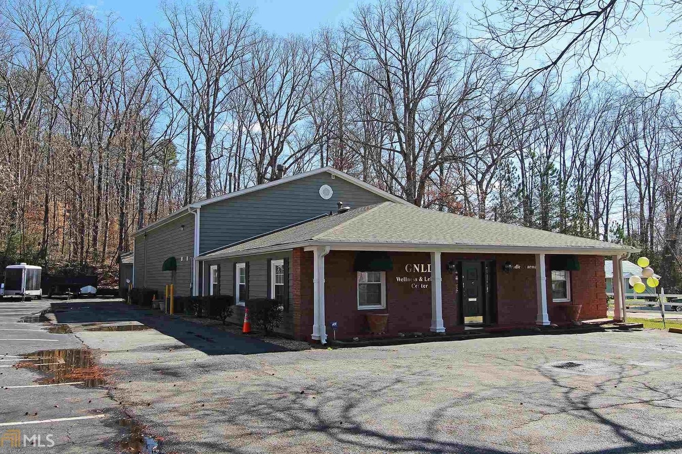
Property Record
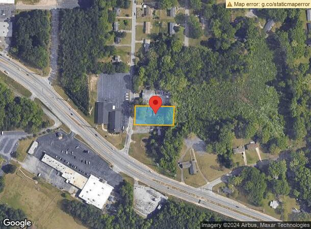
2760 Pleasantwood Dr, Decatur, GA 30034
Current Lease Availabilities
NEARBY LISTINGS FOR SALE OR LEASE
Property Detail
2760 Pleasantwood Dr
15-127-03-008
DeKalb
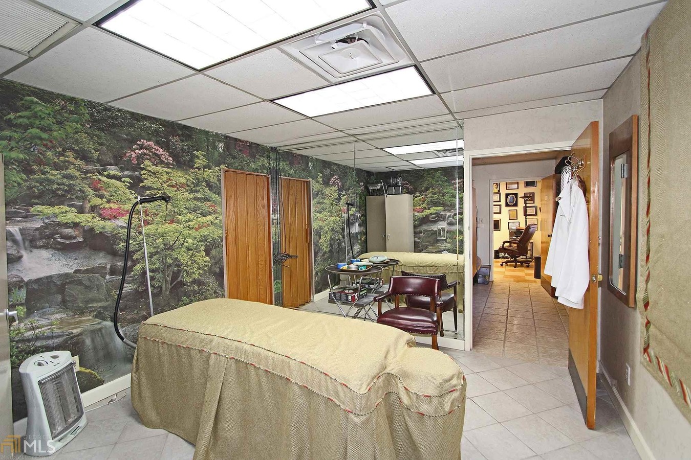
Fratsororityhouse
Georgia
X
8
13089C0154J
0.70 AC
2023
I-20 East/Conyers
2023
Atlanta
023448
Atlanta-Sandy Springs-Roswell, GA
6,096 SF
DEMOGRAPHICS near 2760 Pleasantwood Dr
1 Mile
3 Mile
5 Mile
2024 Total Population
7,007
74,658
208,781
2029 Population
6,900
74,169
208,222
Pop Growth 2024-2029
(1.53%)
(0.65%)
(0.27%)
Average Age
42
40
40
2024 Total Households
2,629
28,000
78,363
HH Growth 2024-2029
(1.56%)
(0.64%)
(0.21%)
Median Household Inc
$60,025
$59,350
$57,254
Avg Household Size
2.60
2.60
2.60
2024 Avg HH Vehicles
2.00
2.00
2.00
Median Home Value
$217,318
$199,503
$196,656
Median Year Built
1981
1982
1982
Nearby Places
- Restaurants
- Banks
- Shops
- Fitness
- Groceries
PUBLIC TRANSPORTATION
AIRPORT
Hartsfield - Jackson Atlanta International
DRIVE
WALK
Distance
Hartsfield - Jackson Atlanta International
25 min
15.9 mi
Freight Ports
Georgia Ports - Savannah
DRIVE
WALK
Distance
Georgia Ports - Savannah
277 min
241.3 mi
Nearby Properties
Address
Land Use
TOTAL SIZE
Lot Size
Zoning
Address
Land Use
TOTAL SIZE
Lot Size
Zoning
317,008 SF
37.40 AC
RM100
Address
Land Use
TOTAL SIZE
Lot Size
Zoning
834,629 SF
64.50 AC
RM100
Address
Land Use
TOTAL SIZE
Lot Size
Zoning
13,114 SF
18 AC
RM100
Address
Land Use
TOTAL SIZE
Lot Size
Zoning
250,496 SF
14.80 AC
OI
Address
Land Use
TOTAL SIZE
Lot Size
Zoning
132,604 SF
19.10 AC
RM100
Address
Land Use
TOTAL SIZE
Lot Size
Zoning
284,650 SF
21.80 AC
R100
Address
Land Use
TOTAL SIZE
Lot Size
Zoning
72,870 SF
12.30 AC
C2
Address
Land Use
TOTAL SIZE
Lot Size
Zoning
174,027 SF
35.36 AC
R100
Address
Land Use
TOTAL SIZE
Lot Size
Zoning
300,697 SF
21.10 AC
RM85
Address
Land Use
TOTAL SIZE
Lot Size
Zoning
86,140 SF
63.60 AC
R100
Address
Land Use
TOTAL SIZE
Lot Size
Zoning
158,939 SF
14.40 AC
RM85
Address
Land Use
TOTAL SIZE
Lot Size
Zoning
814,943 SF
40.70 AC
M
Address
Land Use
TOTAL SIZE
Lot Size
Zoning
277,816 SF
18 AC
RM100
Address
Land Use
TOTAL SIZE
Lot Size
Zoning
182,490 SF
12.40 AC
RM100
Address
Land Use
TOTAL SIZE
Lot Size
Zoning
83,910 SF
10.20 AC
RCH
Address
Land Use
TOTAL SIZE
Lot Size
Zoning
144,950 SF
16.40 AC
RM100
Address
Land Use
TOTAL SIZE
Lot Size
Zoning
292,395 SF
20.70 AC
RM100
Address
Land Use
TOTAL SIZE
Lot Size
Zoning
155,447 SF
12.10 AC
X
Address
Land Use
TOTAL SIZE
Lot Size
Zoning
168,610 SF
19.20 AC
M
Address
Land Use
TOTAL SIZE
Lot Size
Zoning
209,022 SF
16.50 AC
RM100
Address
Land Use
TOTAL SIZE
Lot Size
Zoning
111,885 SF
7.30 AC
X
Address
Land Use
TOTAL SIZE
Lot Size
Zoning
419,434 SF
21.20 AC
RM85
Address
Land Use
TOTAL SIZE
Lot Size
Zoning
153,974 SF
9.90 AC
RM100
Address
Land Use
TOTAL SIZE
Lot Size
Zoning
249,668 SF
17.10 AC
RM100
Address
Land Use
TOTAL SIZE
Lot Size
Zoning
253,740 SF
13.20 AC
RM75
Address
Land Use
TOTAL SIZE
Lot Size
Zoning
208,711 SF
34.30 AC
X
Address
Land Use
TOTAL SIZE
Lot Size
Zoning
33,448 SF
2.07 AC
C-1
Address
Land Use
TOTAL SIZE
Lot Size
Zoning
278,272 SF
21.20 AC
RM100
Address
Land Use
TOTAL SIZE
Lot Size
Zoning
372,399 SF
12.63 AC
M
Address
Land Use
TOTAL SIZE
Lot Size
Zoning
198,695 SF
10.90 AC
X
The World's #1 Commercial Real Estate Marketplace
Connect with us
© 2025 CoStar Group
The information above has been obtained from sources believed reliable. While we do not doubt its accuracy we have not verified it and make no guarantee, warranty or representation about it. It is your responsibility to independently confirm its accuracy and completeness. Any projections, opinions, assumptions, or estimates used are for example only and do not represent the current or future performance of the property. The value of this transaction to you depends on tax and other factors which should be evaluated by your tax, financial, and legal advisors. You and your advisors should conduct a careful, independent investigation of the property to determine to your satisfaction the suitability of the property for your needs.